Download Visitors Guide

fishing in the great smoky mountains of NC

Tuckasegee River

"archive"

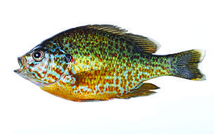
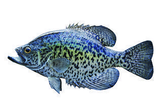
The Tuckasegee, known as the “Tuck,” originates around Cashiers and runs through Sylva, Dillsboro and Bryson City on its way to Fontana Lake. The name Tuckasegee may be an anglicisation of the Cherokee language word [daksiyi—takhšiyi] in the local Cherokee variety—‘Turtle Place.’ The river is dotted with stone fishing weirs built by Native Americans; this practice may have preceded the Cherokee in the area. The weirs are most easily viewed when water levels are low.

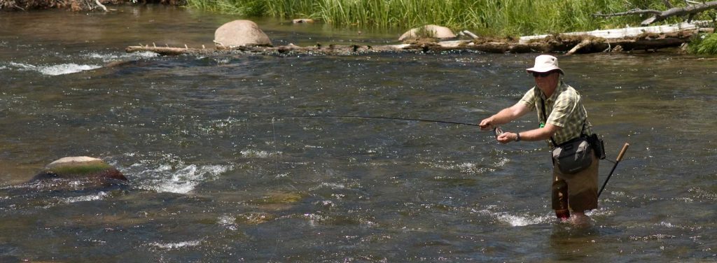
A float trip on the Tuck is an exhilarating way to experience fly fishing in the Southern Appalachians. The river has areas that are as wide as many western rivers, offering plenty of room for back casting. The Tuck is also a popular river for tubing, floating and canoeing.

On most days with no recent rain storms, boating down the river without added water from dam releases can be slow-going, with numerous opportunities to get out and push your boat off the rocks. On the other hand, high water is difficult for fishermen. During the summer, special days (usually Mondays) are set aside for low- water conditions for the bene t of anglers. Whether you are an angler or a kayaker, it is beneficial to know the water levels to enjoy your sport.

It is recommended to check the Daily Schedule of Flows Arrival and Recession Times by visiting www.duke-energy.com. Check with North Carolina Wildlife Resources Commission at www.ncwildlife.org for fishing regulations specific to this river.

Fish Species

"archive"
Rainbow Trout
"archive"
Smallmouth Bass
"archive"
Brown Trout
"archive"
Largemouth Bass
"archive"
Smallmouth Bass
"archive"
White Bass
"archive"
Walleye
"archive"
Catfish
"archive"
Sunfish
"archive"
Crappie

Nantahala River Put-in Points

  • GPS: (lat) 35.431284, (long) -83.442562
  • Water Type: River
  • Water Class:  I-II
  • Launch Type:  Primititve
  • Restrooms:  No
  • Picnic Area:  Yes
  • Universal Access: N/A
  • Time to Next Point:  2 Hours
  • Safety & Other Notes:  Dog Friendly
  • GPS: (lat) 35.452879, (long) –83.393376
  • Water Type:  River
  • Water Class:  I-II
  • Launch Type:  Drift
  • Restrooms:  No
  • Picnic Area:  Yes
  • Universal Access:  N/A
  • Time to Next Point: 3 Hours
  • Safety & Other Notes: N/A
  • GPS: (lat) 35.452879, (long) –83.393376
  • Water Type:  River
  • Water Class:  I-II
  • Launch Type:  Drift
  • Restrooms:  No
  • Picnic Area:  Yes
  • Universal Access:  N/A
  • Time to Next Point: 3 Hours
  • Safety & Other Notes: N/A
  • GPS: (lat) 35.367618, (long) –83.252359
  • Water Type:  River
  • Water Class:  I-II
  • Launch Type:  Drift
  • Restrooms:  No
  • Picnic Area:  No
  • Universal Access: N/A
  • Time to Next Point:  3 Hours
  • Safety & Other Notes:  N/A
  • GPS: (lat) 35.367261, (long) –83.251018
  • Water Type:  River
  • Water Class:  I-II
  • Launch Type:  Drift
  • Restrooms:  No
  • Picnic Area:  No
  • Universal Access:  N/A
  • Time to Next Point:  1 Hour
  • Safety & Other Notes: N/A
  • GPS: (lat) 35.363899, (long) –83.246429
  • Water Type:  River
  • Water Class: I-II
  • Launch Type:  Drift
  • Restrooms:  Yes
  • Picnic Area:  No
  • Universal Access:  No
  • Time to Next Point: 1 Hour
  • Safety & Other Notes:  Change Room Available
  • GPS: (lat) 35.254259, (long) –83.106416
  • Water Type:  River
  • Water Class: I-II
  • Launch Type:  Primitive
  • Restrooms:  No
  • Picnic Area:  No
  • Universal Access:  N/A
  • Time to Next Point:  3 Hours
  • Safety & Other Notes:  Eternity and Slab Play Holes
  • GPS: (lat) 35.298254, (long) –83.147224
  • Water Type:  River
  • Water Class: I-II
  • Launch Type:  Drift
  • Restrooms:  Yes
  • Picnic Area:  Yes
  • Universal Access:  Yes
  • Time to Next Point:  3 Hours
  • Safety & Other Notes:  Pavillion, Volleyball, Basketball
  • GPS: (lat) 35.298254, (long) –83.147224
  • Water Type:  River
  • Water Class: I-II
  • Launch Type:  Drift
  • Restrooms:  Yes
  • Picnic Area:  Yes
  • Universal Access:  Yes
  • Time to Next Point:  3 Hours
  • Safety & Other Notes:  Pavillion, Volleyball, Basketball
  • GPS: (lat) 35.33393, (long) –83.19691
  • Water Type:  River
  • Water Class: I-II
  • Launch Type: Drift
  • Restrooms:  Yes
  • Picnic Area:  No
  • Universal Access:  N/A
  • Time to Next Point:  3 Hours
  • Safety & Other Notes:  Access to Greenway
  • GPS: (lat) 35.432812, (long) –83.360417
  • Water Type:  River
  • Water Class: I-II
  • Launch Type: Drift
  • Restrooms:  No
  • Picnic Area:  No
  • Universal Access:  Yes
  • Time to Next Point:  2 Hours
  • Safety & Other Notes:  N/A
  • GPS: (lat) 35.233695, (long) –83.123101
  • Water Type:  River
  • Water Class:  II
  • Launch Type:  Primitive
  • Restrooms:  No
  • Picnic Area:  No
  • Universal Access:  No
  • Time to Next Point:  1 Hour
  • Safety & Other Notes:  Fishing Trail
  • GPS: (lat) 35.247653, (long) –83.128265
  • Water Type:  Lake
  • Water Class:  I-II
  • Launch Type:  Drift
  • Restrooms:  No
  • Picnic Area:  No
  • Universal Access:  N/A
  • Time to Next Point:  3 Hours
  • Safety & Other Notes:  N/A