Nantahala National Forest
The Nantahala National Forest lies in the mountain and valleys of southwestern North Carolina. The largest of North Carolina’s four National Forests, the Nantahala encompasses 531,148 acres with elevations ranging from 5,800 feet at Lone Bald in Jackson County to 1,200 feet in Cherokee County along Hiawassee River.
The Forest is divided into three Districts, Cheoah in Robbinsville, NC, Tusquitee in Murphy, NC, and the Nantahala in Franklin, NC. All district names come from the Cherokee language. “Nantahala” is a Cherokee word meaning “land of the noon day sun,” a fitting name for the Nantahala Gorge, where the sun only reaches to the valley floor at midday.
The Nantahala National Forest was established in 1920 under authority of the 1911 Weeks Act by President William Taft. This act provided authority to acquire lands for national forests to protect watersheds, to provide timber, and to regulate the flow of navigable streams.
In the Nantahala National Forest, visitors enjoy a wide variety of recreational activities from whitewater rafting to camping. With over 600 miles of trails, opportunities exist for hikers, mountain bikers, horse-back riders and off-highway vehicle riders.
Things to Do/Explore
The Nantahala National Forest offers plenty of adventure at every turn! Be sure to make the most of your visit to the Forest by checking out some of these exciting and beautiful forest features.
Hiking Trails
There are hundreds of miles of hiking trails winding through the Nantahala National Forest. Here are just a few of the trails you can travel on:
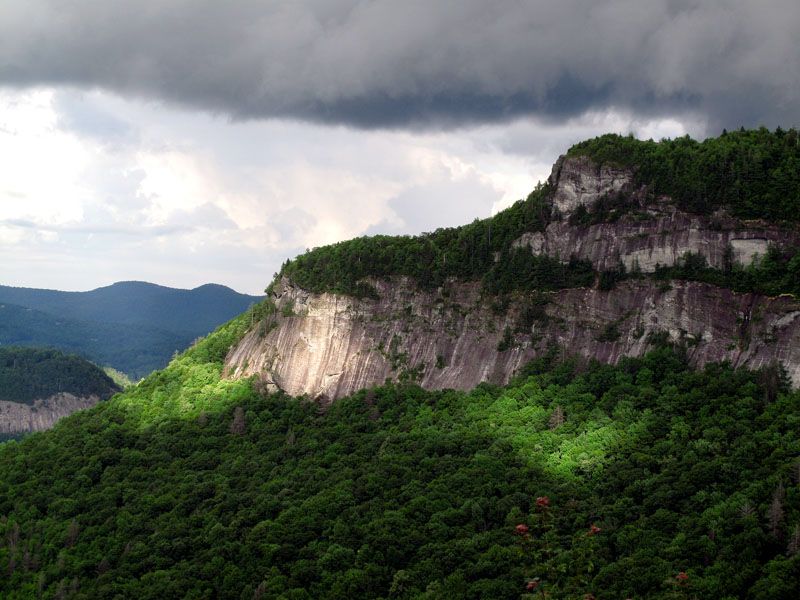
- The Whiteside Mountain Hike: located between Cashiers and Highlands, North Carolina, this two-mile loop trail takes you up 750-ft. high cliffs with outstanding views!
- The Appalachian Trail: The Appalachian National Scenic Trail travels 2,174-miles through multiple states. In the Nantahala National Forest section of the trail, you can hike to Wesser Bald Lookout Tower or Wayah Bald Lookout Tower.
- Panthertown Valley: located in Jackson County, Panthertown Valley consists of 30 miles of maintained, marked trails where you can hike, bike or go horseback riding.
Waterfalls
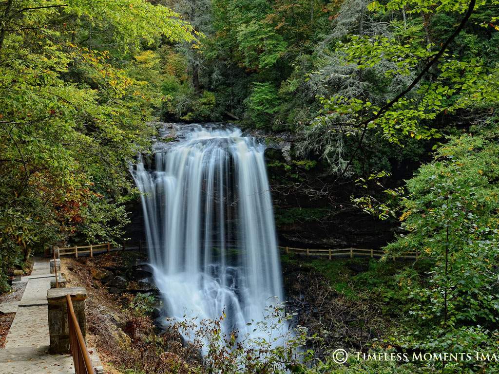
- Dry Falls: this 75-foot waterfall is located near Highlands, NC, along US Highway 64. You can even walk behind this spectacular waterfall!
- Upper Whitewater Falls: this 411-foot waterfall is the highest waterfall east of the Mississippi River!
- Dill Falls: this 50-foot waterfall in Jackson County is only a short hike from the road, and one of the many beautiful waterfalls on Forest Heritage Scenic Byway.

Outdoor Adventures
- Whitewater Rafting: the Nantahala River Gorge is a nine-mile class II-III river that you can kayak, canoe, or raft down!
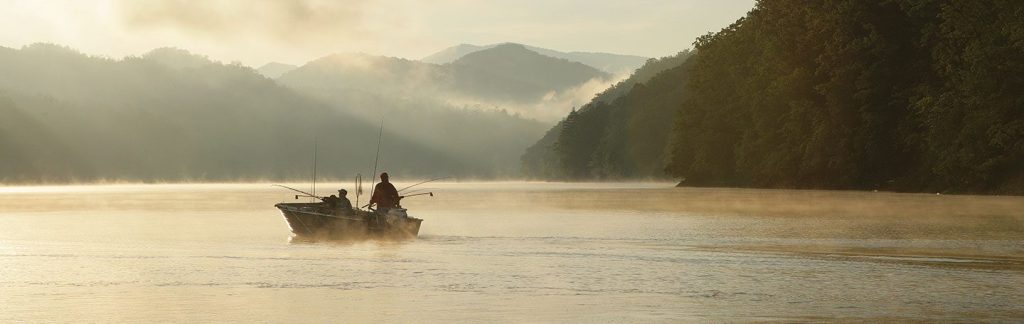
- Fishing: reel in bass, sunfish, walleye, and catfish on Lake Chatuge or Fontana Lake, and find plenty of trout in the Chattanooga River, the Upper Nantahala River, Standing Indian’s Kimsey Creek, or Park Creek, all located in the Nantahala National Forest. Here’s more on fishing in the Smokies.
- Camping: there are plenty of full-featured and primitive campgrounds located in the Nantahala National Forest! Whatever kind of camping adventure you desire, you’re sure to find it here!
Click here for more information from the US Forest Service Nantahala Page.