![]() Because the Parkway experiences regular closures in the winter, you’ll want to ensure it is open during your visit. https://www.blueridgeparkway.org/road-conditions/
Because the Parkway experiences regular closures in the winter, you’ll want to ensure it is open during your visit. https://www.blueridgeparkway.org/road-conditions/
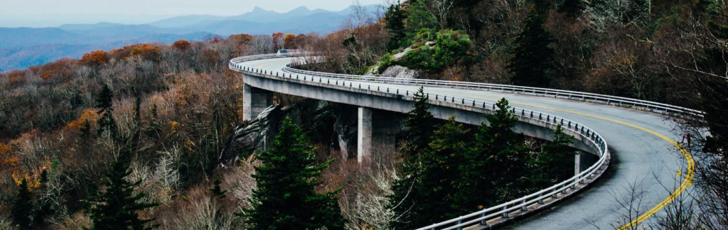
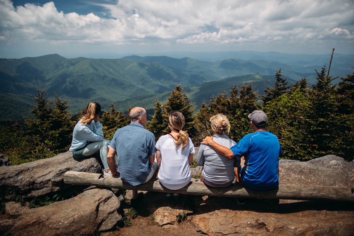
The Blue Ridge Parkway, popularly known as “America’s Favorite Drive,” is not an official national park, but the byway is so popular more people drive on the Blue Ridge Parkway each year than visit the Grand Canyon. The most important factor is that while it will get you from Point A to Point B, the Blue Ridge Parkway itself is the destination. And the undeniable public opinion is that if you can only see one segment, the 61.7 miles between Cherokee in Swain County, NC and Mount Pisgah, NC is the most picturesque with a concentration of must-see sites.
Your drive begins in Cherokee, NC, where the Native American population still practices its language, crafts, dance, ceremonies, and lifestyle. The village welcomes visitors but has seasonal hours, so check for dates before you come.
Within your first few minutes on the Parkway, you will be overcome with a sense of peace, stillness, awe and relaxation. Some have compared the experience to traveling through old New England back roads in the 1800s, especially in autumn when the foliage is at its peak. The speed limit tops out at 45 miles an hour (lower near towns), but there is an abundance of wildlife on and along the parkway, like black bears, deer, rabbits, and birds, so you need to always be aware of your surroundings.
People also bicycle along the byway with very little room between your car and the shoulder, so most drivers wait until it opens up a bit more to pass. (Insider tip: you may get someone impatiently riding your bumper, but the park rangers do ticket for such behavior. That being said, please also be courteous and let the line of cars behind you pass if you have the opportunity.)
Hiking Trails and Scenic Spots
Sliding Rock
For the experience of a lifetime, don’t miss Sliding Rock on the Blue Ridge Parkway. It’s a cool place on Looking Glass Creek where visitors can slide down its face into a plunge pool. There are plenty of sunning rocks if you just want to be a spectator. You won’t regret a thing.
Skinny Dip Falls Trail
Known for its stunning waterfalls and three-tiered swimming holes, Skinny Dip Falls is a stone’s throw from Graveyard Fields and Sliding Rock and well worth the time. While it is not unheard of to encounter nudists at Skinny Dip Falls, it isn’t very likely, as most travel farther into the wild before disrobing.
Keep an eye out to the south for one of the most popular landmarks on the Blue Ridge Parkway, Shining Rock. With its white granite peak, it is easily visible from the Shining Rock Outlook. When the sun is high, the white granite shimmers! Time to see this splendor for yourself!
Graveyard Fields
Graveyard Fields is a wonderland of hiking trails, waterfalls and long-distance vistas. This area is listed as one of the most popular hiking areas in the Blue Ridge National Heritage Area.
There is much lore around the history of the name – everything from a tremendous windstorm that ripped most of the trees from the ground to stories of drastic, unregulated overlogging prior to the site’s protection. Either way, the remaining stumps looked remarkably like headstones in a field. In the 1920s and 1940s, wildfires ravaged the area, returning the stumps to the earth, scorching the soil, and transforming the site into what you see today.
With a cascading waterfall just a short distant from the overlook and beckoning for spring and summer visitors to come for a dip, Graveyard Fields is also known for its blueberry patches.
(Insider tip: each visitor is allowed to pick up to one gallon of blueberries along the trail, so bring your bucket. Also stay alert because the black bears are just as likely to be enjoying a delicious snack while you are.) Of course, this site is equally, if not more, stunning in autumn with red, yellow, and orange foliage burning up the sky.
Art Loeb Trail
If the Appalachian Trail is the Granddaddy of challenging, test-yourself trails, then the 30.1-mile Art Loeb Trail is easily the Daddy. Known as one of the most difficult hikes along the Blue Ridge Parkway and the region in general, this trail tackles the peaks and ridges of the mountain instead of the valleys.
Art Loeb was an activist with the Carolina Mountain Club who fought to maintain the integrity and natural beauty of this trail that officially became a designated National Recreation Trail. At the end of the trail, you’ll descend Cold Mountain, famous for the best-selling book and movie starring Nicole Kidman, Jude Law and Renee Zellweger.
Hikers seeking a real challenge should plan a two-or-three day back-packing trip on the trail, while the more casual hikers will be thrilled with the huge selection of shorter, easier-to-traverse trails. For those planning to take on the whole Art Loeb Trail, there are plentiful camping spots along the way on a first-come, first-serve basis.
Devil’s Courthouse
When you look out at the Devil’s Courthouse with its towering rocky exterior and, perhaps, the devil’s profile outlined at the peak, it doesn’t take a lot of imagination to envision why it is named the Devil’s Courthouse. However, legend maintains there is a deep cave in the side of the mountain that is the actual origination of the name.
Regardless, this is a beautiful but strenuous half-mile hike that leads you past some of the rarest plants in these mountains, including Rock Gnome Lichen and the Spreading Avens dating back to the last glacial period. On a clear day, you can see four states – North Carolina, South Carolina, Tennessee, and Georgia. Bring a picnic lunch to enjoy at the overlook while deciding for yourself if this outcropping is truly “sinister.”
Waterrock Knob
Named for the nearby mountain spring where hunters once filled their canteens, Waterrock Knob is a popular spot with hikers, photographers, and birdwatchers and easily accessed from the Blue Ridge Parkway. (Leashed dogs are also welcome on the hike.) The Waterrock Knob Trail is a .9-mile trail directly off the Blue Ridge Parkway.
Enjoy the scent of wildflowers and fresh mountain air as you climb the half-mile trail to the summit where the mountain hugs the sky. The trail difficulty is a subject of some debate; seniors and children alike share that they made the climb with relative ease, but the trail gets steeper and a little more difficult as you near the turn-around point. However, one thing everyone agrees upon is that the climb is well worth the rewarding, long-distance views from the peak.
There is a small visitor’s center selling souvenirs and snacks, and picnic tables and restrooms are available. If they aren’t too busy, the staff may be cajoled into sharing some of their most interesting trail stories with you.
If you have more energy and a love of history, there is a 40-year-old plane wreck about 2.5 miles roundtrip from Waterrock Knob, across to Browning Knob. It is not an easy hike, so plan accordingly for the whole family. Also, this is a site of great travesty and sadness, and hikers are encouraged to be respectful during their visit to the downed plane.
Richland Balsam Nature Loop Trail
The Richland Balsam Nature Loop trail is famous for being the highest peak on the Blue Ridge Parkway at 6053 ft. (although not the highest in Western North Carolina – that honor goes to Mt. Mitchell) and carries the distinction of being the “best-smelling trail” on the Parkway. The 1.5-mile, moderately difficult loop trail takes you past spectacular fields of wildflowers and through a heady spruce-fir forest. The view is almost as striking from the easy-to-reach overlook.
Ways to Explore the Parkway
RVing
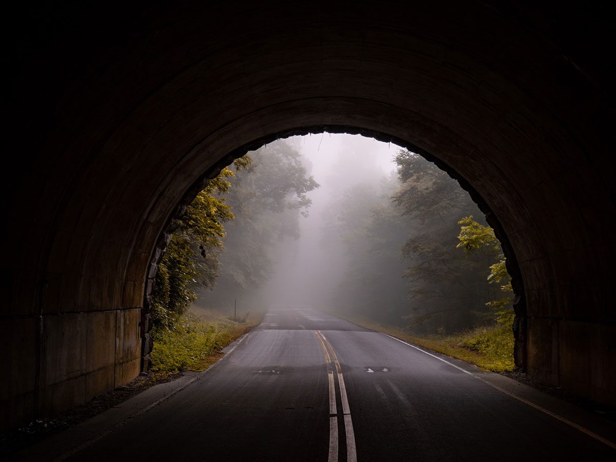
For you vacationers who like to travel with the luxuries of home close by, RVing on the Blue Ridge Parkway wins the day! While a larger recreational vehicle can be a bit more cumbersome to drive along the 75-year-old Blue Ridge Parkway, it remains doable if you can navigate through the center of the tunnels for the best clearance. You should also take advantage of the pull-offs to cool your engine and brakes. Please check out the road situation before you go to make sure your RVing will go off without a hitch.
Camping
The Parkway does not allow what they call “stealth’ camping, meaning you find a nice spot and pitch your tent outside of the allowed camping areas. But there are plenty of scenic campgrounds along this stretch of the Blue Ridge Parkway, and you should be able to find a “legal” spot fairly easily. It’s important to keep in mind that many of the campgrounds do not open until May. Check out this comprehensive list of Area Campgrounds.
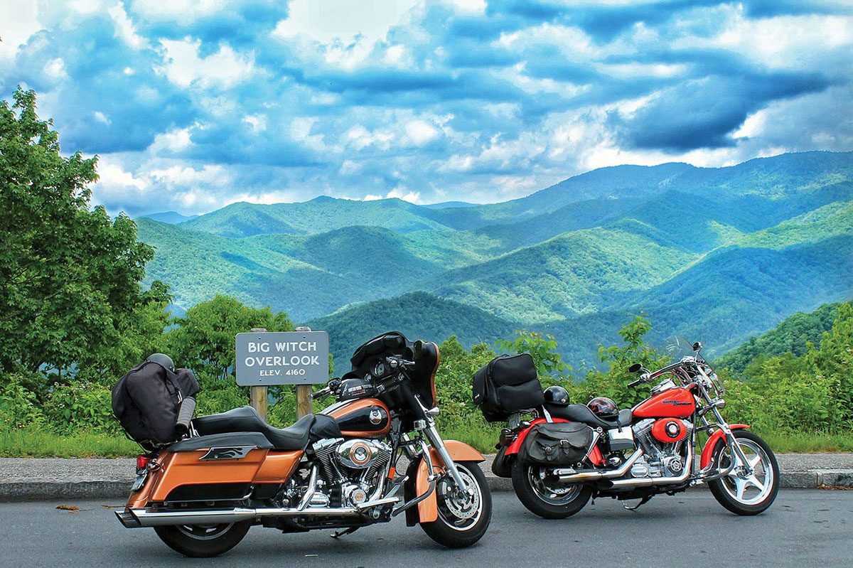
Motorcycling and Bicycling
The parkway is well known amongst motorcycle enthusiasts, especially for the winding turns and breathtaking scenery. There is no rush as you meander the byway at a more leisurely pace – the speed limit never gets over 45 – while you visit the small towns and sites along the way. For more information, visit the Blue Ridge Parkway website.
Because the Blue Ridge Parkway was constructed for motor vehicles, cycling is not the first activity to come to mind when planning your trip. There are no bike lanes, and, for safety’s sake, the Parkway’s cycling regulations should be followed. For more information about the cycling regulations, as well as some valuable information about the elevations to expect, visit the National Park website
Birding on the Blue Ridge Parkway

The Blue Ridge Parkway is home to several unusual birds, including the Belted Kingfisher, Bald Eagle, Peregrine Falcon, and Spotted Sandpiper. Be sure to visit the trail meadows to catch a glimpse of Eastern Bluebird and Common Yellowthroat. Learn more about these birds as well as amazing migration rituals at Blue Ridge National Heritage Area. Here are other places to go birding in the Smoky Mountains.
Insider Tip: For many years and as recently as 2016, the Devil’s Courthouse was home to nesting Peregrine Falcons during their migration. Because humans are becoming a more regular feature of these grounds, and not everyone understands the negative effect of human proximity, there have been no new nests recorded here in the last several years. However, with patience, these majestic birds can still be spotted by the lucky few.
Lodging and Dining
The Cherokee-to-Mount-Pisgah segment of the Blue Ridge Parkway is a mecca of small towns with local restaurants and lodging all along the way. While this segment of the drive is very doable in a day (depending on how often you stop), you can’t go wrong with your choices to stay along the route. On the southernmost point, find a list of members in the Haywood County Hotel and Motel Association.
For an authentic mountain getaway, consider staying in one of the original, hand-hewn log cabins at Boyd Mountain Log Cabins, a 10-minute drive from the Parkway outside of Maggie Valley and Waynesville. The cabins have been updated with modern conveniences without losing the charm of the original lodging.
For a truly immersive Western North Carolinian experience, plan to spend some time in the tasting room at the FernCrest Winery in Andrews, NC. For the perfect lunch or snack, pick up a bottle of Royal White, a dry, crisp wine made from vineyard-grown Vidal Blanc grapes and pair it with local Farmstead cheese from Yellow Branch Creamery and Peach Three Pepper Jam from maams HotJam.
At the other end of this journey is the Pisgah Inn on the peak of the Parkway, the only lodging directly on the byway. The dining room and inn is only open from April 1 to October 31, so plan accordingly. The rooms feature balconies with stunning views of the surrounding mountains and vistas, or you can opt to relax in the iconic rocking chairs on the main porch.
Many locals make the drive just to eat in the dining room with panoramic views for miles. You must try the real-deal breakfast grits (especially first timers) and the Southern Corn Fritters and Mountain Fried Half Chicken for dinner. They also have a grab-and-go cafe if you want to enjoy the picnic tables or are just in a hurry, although time does move more slowly down here, perhaps because of the delicious fried food. Also stop in at the gift shop for local art and souvenirs at very reasonable prices. Learn More at Pisgah Inn.
Of course, for full-on luxury, there is no better place than Harrah’s Cherokee Valley River Casino with its spectacular shows, exhilarating games, and gourmet dining options, like Ruth’s Chris Steakhouse.
There is so much more to discover about the Blue Ridge Parkway between Cherokee and Mount Pisgah, NC. Come discover for yourself!
The Visitor Center for the Blue Ridge Parkway in North Carolina
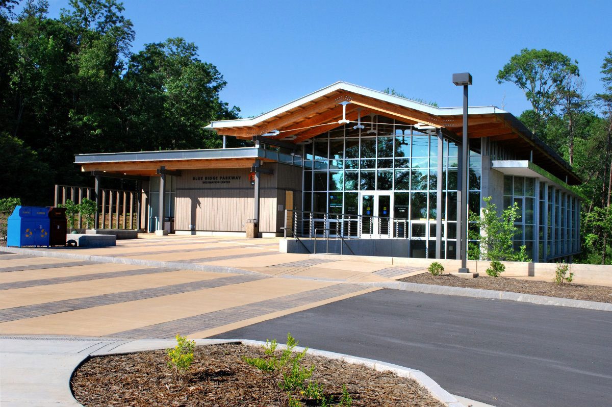
The Blue Ridge Parkway Visitor Center in Asheville, North Carolina features an award-winning film and exhibits which highlight the natural and cultural heritage, economic traditions, and recreational opportunities found in and along the Blue Ridge Parkway in North Carolina.
The visitor center houses a 70-seat theater, information and orientation services, and a retail shop offering books, apparel, CDs, DVDs, collectibles, souvenirs, and children’s items.
Hours of Operation
Hours of operation are from 9 am to 5 pm daily, year-round. The visitor center is closed on Thanksgiving, Christmas Day, and New Year’s Day.
Location
The Blue Ridge Parkway Visitor Center is located at Parkway milepost 384, which is about a mile south of the US 70 intersection (or one mile north of the US 74-A intersection) and about 8 miles east of downtown Asheville. The Folk Art Center is located nearby, two miles to the north along the Blue Ridge Parkway in North Carolina.
Check Road Conditions
As inclement weather affects the Blue Ridge Parkway, use the newly launched real-time closure map to check the road conditions before setting out on a Parkway journey.
Extreme weather conditions at the higher altitudes along the Parkway often force the temporary closure of some segments and also cause roadway erosion that results in unexpected closures.
The Blue Ridge Parkway Road Closure Map provides real-time road closure/condition information throughout the season. It’s great for residents who frequently travel the Parkway, and also for visitors who are likely unfamiliar with the weather in the mountains, so be sure to let your friends and family who are visiting know about this map.
Blue Ridge Parkway Visitor Center
Parkway Milepost 384
195 Hemphill Knob Road
Asheville, NC 28803
(828) 298-5330
www.BlueRidgeHeritage.com