Download Visitors Guide

rafting in the great smoky mountains of NC

Nantahala River

"archive"

The Nantahala rises near the border of Georgia and North Carolina, close to the Southern Nantahala Wilderness and the Appalachian Trail. It empties into the Little Tennessee River at Fontana Lake.

The word “Nantahala” comes from the Cherokee language and means “Land of the Noonday Sun.” The river runs through a narrow and steep gorge where in some areas the sun only reaches the ground when it is directly overhead during the middle of the day.

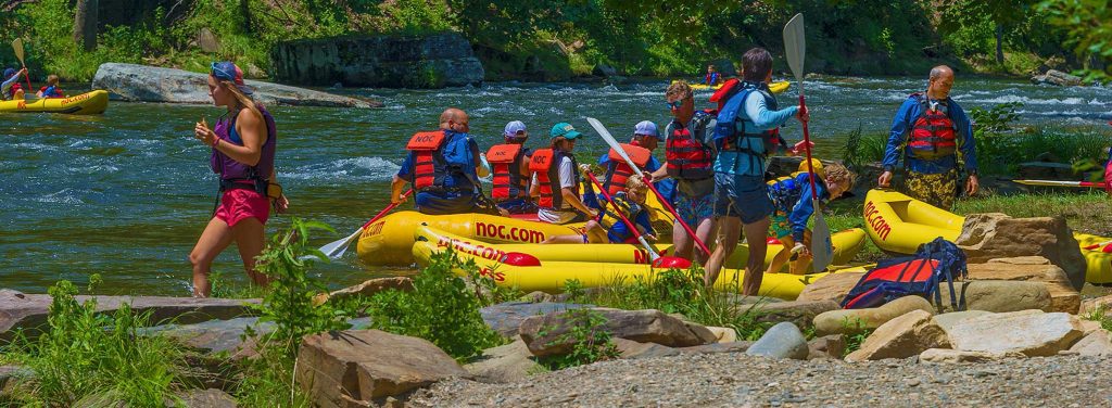
Nantahala offers river rafting and kayaking through family-friendly rapids and is a popular spot for the amateur as well as the Olympic paddler. It features eight miles of Class II rapids before splashing through the exciting Class III whitewater of Nantahala Falls. This is one of America’s most popular whitewater runs that hosted the 2013 International Canoe Federation’s Freestyle World Championships!

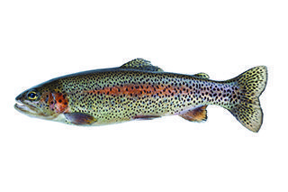
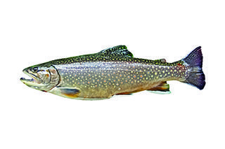
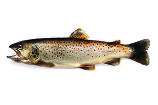
The Nantahala is also a very popular trout fishing destination. North Carolina Game and Fish named the Nantahala one of North Carolina’s ten best trout streams. The trout fishing on the Nantahala is so good in fact that Trout Unlimited included it on its list of the top 100 Trout Streams in the U.S.

Check with North Carolina Wildlife Resources Commission at www.ncwildlife.org for fishing regulations specific to this river.

Fish Species

"archive"
Rainbow Trout
"archive"
Brook Trout
"archive"
Brown Trout

Nantahala River Put-in Points

  • GPS: (lat) 35.247951, (long) -83.64399
  • Water Type: River
  • Water Class: IV-V
  • Launch Type: Primitive
  • Restrooms: No
  • Picnic Area: No
  • Universal Access: N/A
  • Time to Next Point: N/A
  • Safety & Other Notes: Whitewater – experts only
  • GPS: (lat) 35.246991, (long) -83.653919
  • Water Type: River
  • Water Class: III
  • Launch Type: Primitive
  • Restrooms: No
  • Picnic Area: No
  • Universal Access: N/A
  • Time to Next Point: N/A
  • Safety & Other Notes: Whitewater – experts only
  • GPS: (lat) 35.248235, (long) -83.65568
  • Water Type: River
  • Water Class: III-IV
  • Launch Type: Primitive
  • Restrooms: No
  • Picnic Area: No
  • Universal Access: N/A
  • Time to Next Point: N/A
  • Safety & Other Notes: Whitewater – experts only
  • GPS: (lat) 35.27405, (long) -83.681247
  • Water Type: River
  • Water Class: II+
  • Launch Type: Drift
  • Restrooms: No
  • Picnic Area: Yes
  • Universal Access: N/A
  • Time to Next Point: 2 Hours
  • Safety & Other Notes: Fee Required
  • GPS: (lat) 35.302995, (long) -83.653534
  • Water Type: River
  • Water Class: II+
  • Launch Type: Drift
  • Restrooms: Yes
  • Picnic Area: Yes
  • Universal Access: N/A
  • Time to Next Point: 2 Hours
  • Safety & Other Notes: Fee Required
  • GPS: (lat) 35.332912, (long) -83.627854
  • Water Type: River
  • Water Class: II+
  • Launch Type: Primitive
  • Restrooms: No
  • Picnic Area: Yes
  • Universal Access: N/A
  • Time to Next Point: 3 Hours
  • Safety & Other Notes: N/A
  • GPS: (lat) 35.333283, (long) -83.597045
  • Water Type: River
  • Water Class: II-III
  • Launch Type: Primitive
  • Restrooms: No
  • Picnic Area: Yes
  • Universal Access: N/A
  • Time to Next Point: N/A
  • Safety & Other Notes: Hazard Below NOC